A training test from a PDF guide: an easy quiz for beach survey volunteers
A NOAA shoreline survey guide (public domain) became an easy six-question test for volunteers at the end of their training. Read it and copy the request.
How this was made. Audio and video overviews, slide decks, infographics and quizzes are made with Google's Gemini Notebook (formerly NotebookLM), on accounts that AutoContent operates. AutoContent has no agreement with Google. Google can limit or stop this access at any time.
1. When preparing before leaving home, what tide condition should surveyors plan to arrive during?
- AAny time of day regardless of tide level
- BA high or incoming tide
- CPeak slack high tide
- DA low or outgoing tide
Hint: Consider how coastal water levels affect beach access and safety during field activities.
Show the answer
- A · Not correctIgnoring tide schedules can submerge survey transects and compromise safety and standardization.
- B · Not correctIncoming tides shorten the available survey area and present a potential stranding hazard in some coastal regions.
- C · Not correctHigh tides cover significant portion of the beach substrate, restricting access to debris.
- D · CorrectArriving during a low or outgoing tide provides standardization and prevents water from encroaching on survey activities or causing stranding hazards.
2. How many 5-meter transects must be randomly selected for each survey event at a 100-meter site?
- AFour
- BFive
- CTen
- DTwo
Hint: Think about the required number of random 5-meter sample sections out of the 20 possible segments.
Show the answer
- A · CorrectThe standardized protocol requires selecting a truly random sample of four 5-meter transects per survey.
- B · Not correctFive transects exceeds the required standard four-transect sample per survey event.
- C · Not correctTen transects would cover half of the site, which goes beyond the standard sampling procedure.
- D · Not correctSelecting only two transects provides insufficient sampling coverage for the standardized survey design.
3. Which datasheet must be completed once per survey event to document overall conditions at the site?
- ASurvey Coversheet
- BTransect Survey Form
- CShoreline Site Characterization Form
- DMDMAP Item Categorization Guide
Hint: Focus on the form designed to capture overall metadata for the entire survey session.
Show the answer
- A · CorrectThis form captures environmental factors and overall site conditions present during a specific survey event.
- B · Not correctFour individual transect forms are completed per survey event, one for each specific transect searched.
- C · Not correctThis form is completed only once when a site is first established, unless major physical shifts occur.
- D · Not correctThis serves as a reference manual for identifying debris types rather than a recording form.
Show all 6 questions
4. What is the maximum number of people permitted to search for debris within a single transect?
- AOne person
- BAny number of volunteers
- CTwo people
- DFour people
Hint: Consider how controlling team size maintains consistent search effort across different surveys.
Show the answer
- A · Not correctWhile a solo surveyor is permitted, two people represent the upper limit for a single transect.
- B · Not correctUnrestricted group sizes in a transect distort detection probability and effort metrics.
- C · CorrectLimiting search teams to one or two people standardizes search effort so counts remain comparable across surveys.
- D · Not correctAllowing four people into one transect inflates search effort and reduces comparability across survey dates.
5. What is the minimum length threshold for debris items to be counted on the Transect Survey Form?
- A5.0 centimeters in the longest dimension
- B2.5 centimeters in the longest dimension
- C1.0 centimeter in the longest dimension
- DAny item visible without magnification
Hint: Recall the visual reference of a standard bottle cap used as a cutoff size.
Show the answer
- A · Not correctA 5.0 cm threshold is larger than the established minimum size cutoff.
- B · CorrectOnly items measuring 2.5 cm (roughly bottle cap size) or larger in their longest dimension are included in standard counts.
- C · Not correctItems smaller than 2.5 cm are less reliably detected during visual transect scans and are excluded from standard counts.
- D · Not correctCounting all visible items without a lower size limit creates inconsistency due to varying human visual capability.
6. Where should site photos be taken when documenting a survey on the Survey Coversheet?
- AStanding at the center of each individual transect
- BStanding on a dune peak outside the site boundaries
- CStanding at the water's edge looking directly out toward the horizon
- DStanding at the 0 and 100 meter points looking toward the center of the site
Hint: Think about where a surveyor stands to record panoramic views of the site from both ends.
Show the answer
- A · Not correctCenter photos within transects are used for transect-specific documentation rather than site-level coversheet photos.
- B · Not correctOff-site elevated photos do not match the standardized endpoint perspective specified by the protocol.
- C · Not correctFacing open ocean does not capture shoreline substrate, back barriers, or debris distribution.
- D · CorrectTaking photos from both endpoints facing inward captures complete overview images of the shoreline site over time.
- Questions
- 6 questions
- Credits used
- 10 credits
- Cost on the Starter plan
- €0.29
- Generation time
- 1 min 43 s
- Format
- Quiz
- Job
- Training material
- Language
- English
- Generated on
- 2026-11-04
This output used 10 credits, which is €0.29 on the Starter plan (€29 per month for 1,000 credits). Failed generations use none. Generation time runs from the request to the finished file; it depends on the sources, the options and the queue.
What came out, and what we would change
We sent the PDF of NOAA's Marine Debris Monitoring and Assessment Project Shoreline Survey Guide (public domain) and asked for a short test for volunteers at the end of their training class: one question for each step of the survey, in the order of the guide. With quizDifficulty at easy, the quiz has six single-answer questions.
The questions cover the steps that a volunteer must know: arrive at a low or outgoing tide, pick four random transects, fill in the site form once per survey, let no more than two people search one transect, record only items of at least 2.5 centimeters, and take the site photos from both ends. All six marked answers match the guide.
Some explanations add points that are not in the guide, for example that high tides cover the beach and that transect photos are taken from the center of a transect. The hint of question 6 calls the site photos panoramic, but the guide says to take them from both ends, looking toward the center of the site. One explanation has a missing word ("cover significant portion").
Easy questions check the key rules without trick options, which suits a short test at the end of a class. The quiz took 1 min 43 s to generate and used 10 credits.
More outputs of this kind: AI quiz maker.
The exact request
The body that was sent to POST /content/Create, unchanged, and the same request as curl.
{
  "resources": [
    {
      "type": "file",
      "content": "https://marinedebris.noaa.gov/live/s3fs-public/publications-files/MDMAP_Shoreline_Survey_Guide_2021_TM_NOS-ORR_56.pdf"
    }
  ],
  "outputType": "quiz",
  "quizDifficulty": "easy",
  "text": "A short test for volunteers at the end of their training class on this survey guide: one question for each step of the survey, in the order of the guide. Use only facts that the guide states.",
  "language": "English"
}
curl -X POST "https://api.autocontentapi.com/content/Create" \
-H "Authorization: Bearer $AUTOCONTENT_API_KEY" \
-H "Content-Type: application/json" \
-d '{"resources":[{"type":"file","content":"https://marinedebris.noaa.gov/live/s3fs-public/publications-files/MDMAP_Shoreline_Survey_Guide_2021_TM_NOS-ORR_56.pdf"}],"outputType":"quiz","quizDifficulty":"easy","text":"A short test for volunteers at the end of their training class on this survey guide: one question for each step of the survey, in the order of the guide. Use only facts that the guide states.","language":"English"}'
# then poll until "status" is 100:
curl -H "Authorization: Bearer $AUTOCONTENT_API_KEY" "https://api.autocontentapi.com/content/Status/<request_id>"How we checked it
- Questions
- We checked every question, its marked answer and each explanation against the source.
- Notes
- Review notes, against the guide: all six marked answers match it. Some explanations add points that are not in the guide, for example that high tides cover the beach (question 1) and that transect photos are taken from the center of a transect (question 6). The hint in question 6 calls the site photos panoramic, but the guide says to take them from both ends, looking toward the center of the site. One explanation in question 1 has a missing word: "cover significant portion".
- Checked on
- 2026-11-04. Failed generations are run again and never published.
More examples
All examples- Before the snowfall or freezing precipitation season begins, what preparation must be done to a standard manual rain gauge?A Install an automatic heating element inside the inner measuring tube.B Cover the outer cylinder with a white wooden board to keep debris out.C Fill the inner measuring tube with warm water to prevent freezing.Quiz · EnglishPDF to quiz generator: a weather service guide as fourteen check questions14 questions · 10 credits (€0.29 on Starter)
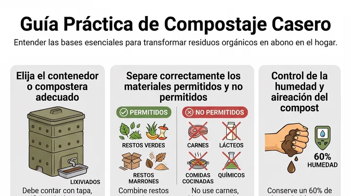 Infographic · SpanishInfografía con IA a partir de una guía: cómo hacer compost en casaOne image · 10 credits (€0.29 on Starter)
 Explainer video · EnglishPDF to video: a six-page guide turned into a training video8 min 12 s · 50 credits (€1.45 on Starter)